When it comes to hiring laser scanning providers, our experience over the past years has been vast and diverse. After considerable time providing reality capture services to our clients we understood that when price, quality, and logistics is about, there is a great deal of uncertainty and unpredictability.
At ENG, we want to see challenges as opportunities and that is why we created SirVey, to make laser scanning easy for everybody, that is our mission!
Let’s start with why!
The Reality Capture Industry challenges:
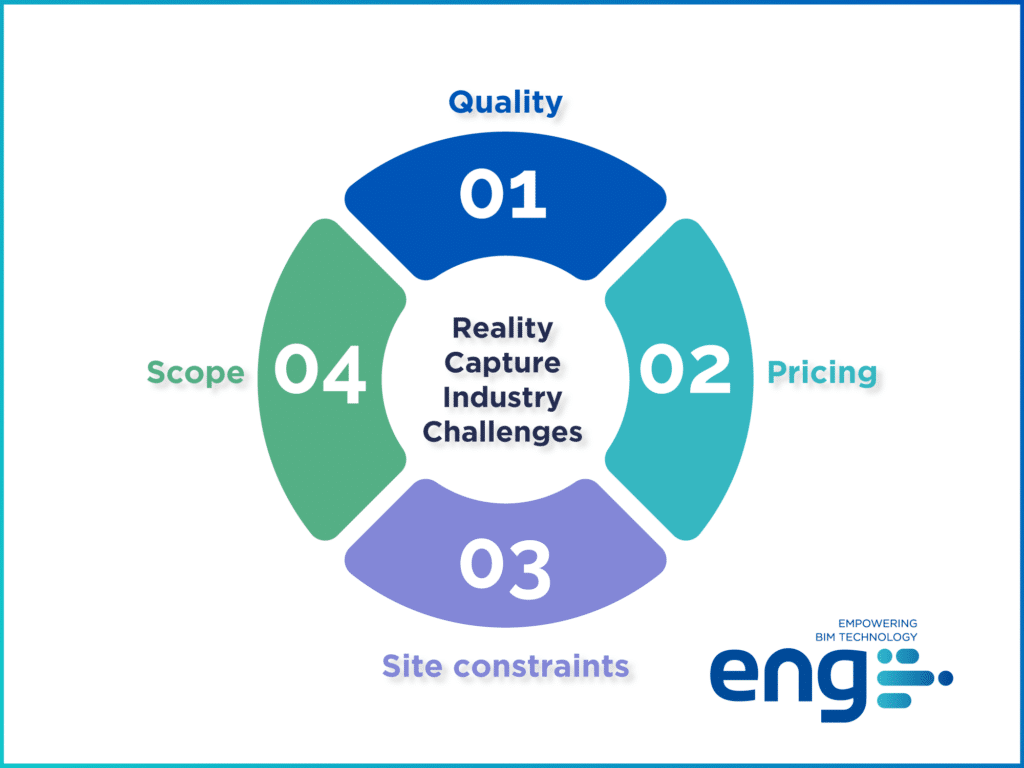
Quality
Quality is not negotiable for us and, as heavy point cloud users, we can say that we are the main victims of poor-quality data. Either because of choosing the wrong technology or due to not having enough experience in the geospatial capture field, among other factors, choosing a new laser scanning provider can be a real challenge. And we feel qualified to make that statement because we learned the hard way that point cloud integrity dramatically affects not only how an existing-conditions model will be developed but also how trustworthy it will be down the road. The project typically starts with (and from) our existing conditions model and we know that an incomplete or inaccurate 3D model impacts all the stakeholders and processes downstream in the design, coordination, and construction process.
Pricing
From a pricing standpoint, how much should we pay in order to get our project scanned? To what extent do travel costs and accommodation fees impact the overall scanning cost? How much productive time does a laser scanning technician lose by getting around and waiting at the airport boarding gate? How much does equipment shipping cost? These, and many more, are the questions we ask ourselves on a daily basis.
The Scope
Scope of work is a crucial factor when budgeting laser scanning work. As you may already know, the scanning purpose determines the technology to be utilized along with the associated deliverables.
When attempting to refine the scope of work, many questions may arise: Does the project need survey control? Is above-ceiling scanning necessary? What will the scanned data be used for? Do we want the point cloud data for space planning, marketing material or to coordinate MEP trades for future retrofits? Should we scan the façade, roof, and site as well? You get the point.
The site constraints
The site conditions can dramatically impact scanning times. Should we cut holes in the hard ceiling to pass the scanner through or are there removable ceiling tiles that can be reasonably easily popped out? Is the roof accessible or should we scan from the surrounding buildings? Is flying a drone permitted in that specific area? Is the pilot certified? Should we rent a scissor lift to access some attic spaces? Who will take care of all those logistics? This sounds like a huge coordination effort, doesn’t it?
Why SirVey?
The above-outlined challenges have made us realize that technology can sometimes be overwhelming and, because there is no doubt for us that reality capture is the way to go for all AECO projects, we want to change that perception!
But what is SirVey then?
By applying the principle of Shared Economy like Airbnb or Uber, we want to ‘uberize’ the laser scanning processes by connecting AEC stakeholders that need laser scanning for their projects with the closest and best possible service provider. With this, we ensure more predictable quality results and provide the best user experience through ENG’s project management and communication standards.
Our purpose
We aim to promote and democratize the use of laser scanning technology, by making it accessible to everybody and, in order to accomplish that, we are determined to make it easy.
Does your project need colored scans and 360 pictures? Do you need terrestrial, aerial, or mobile scanning? What about the point cloud density, file breakdown, and size? How are those heavy files transferred and stored? Let SirVey take care of that for you!
Is there any insurance required to access the site? Security training? PPEs? We’ve got you covered! We coordinate and oversee the entire process, you just unplug. And of course, we can assist you with BIM models and drawings as well.
You might be wondering: ‘how do these guys then ensure quality?’. You might be thinking: ‘What if I have projects everywhere? how do you make laser scanning cost-effective?’
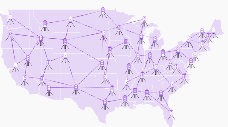
We have created a network of prequalified laser scanning providers covering all major national domestic markets. This means that we are locals and that our technicians are located within driving distance of your projects. And since we are close by, we have a really fast turnaround time. Plus, as we bid on every project, we can offer the most competitive option. An finally, since our providers go through a thorough qualification process to become part of our network, reliability on our deliverables is assured.
I bet you already realized that we are so thrilled with the release of our new platform! We are so excited to see what opportunities unfold with the rollout of this new tool.
Want to give it a try? Go to www.sirvey.us

ENG
For more information, contact us!
E-mail: eng@engbim.com
Call us: (949) 340-6924
