Over the last few years, LiDAR (Light Detection and Ranging) has revolutionized how we perceive and document our environment. This laser scanning-based technology enables the precise modeling of physical spaces. Its impact spans multiple industries, such as construction, infrastructure, environmental research, and autonomous navigation. This article explores LiDAR’s technology core principles, diverse applications, key benefits, and challenges, focusing on its role in the AEC (Architecture, Engineering, and Construction) industry.
What is LiDAR? The Fundamentals
LiDAR (Light Detection and Ranging) is a remote sensing method that uses laser pulses to determine distances between the scanner and surrounding objects. Such technology emits laser beams, reflecting off surfaces and returning to a sensor that records travel time. When calculating these return times with the speed of light, the system determines precise spatial distances. As a result, it creates a highly accurate three-dimensional representation of the scanned environment.
A typical LiDAR system consists of:
- Laser Source – Generates laser pulses for measurement.
- Receiver (Photodetector) – Captures returning signals and records travel times.
- GPS and IMU (Inertial Measurement Unit) – Provides spatial orientation and positioning.
- Point Cloud Processing Software – Converts collected data into detailed 3D models.
Ultimately, when emitting hundreds of thousands of laser pulses per second, LiDAR technology builds dense point clouds that accurately depict terrain, buildings, and objects. This results in crucial data to generate digital twins, facilitating accurate as-built documentation and supporting various engineering applications.
What is the LiDAR Scanner used for?
LiDAR technology is fundamental to laser scanning, enabling precise 3D modeling, terrain mapping, and structural analysis across multiple industries. Each application leverages LiDAR’s ability to capture detailed point clouds accurately, improving data-driven decision-making and operational efficiency. The following are the primary categories of LiDAR applications:
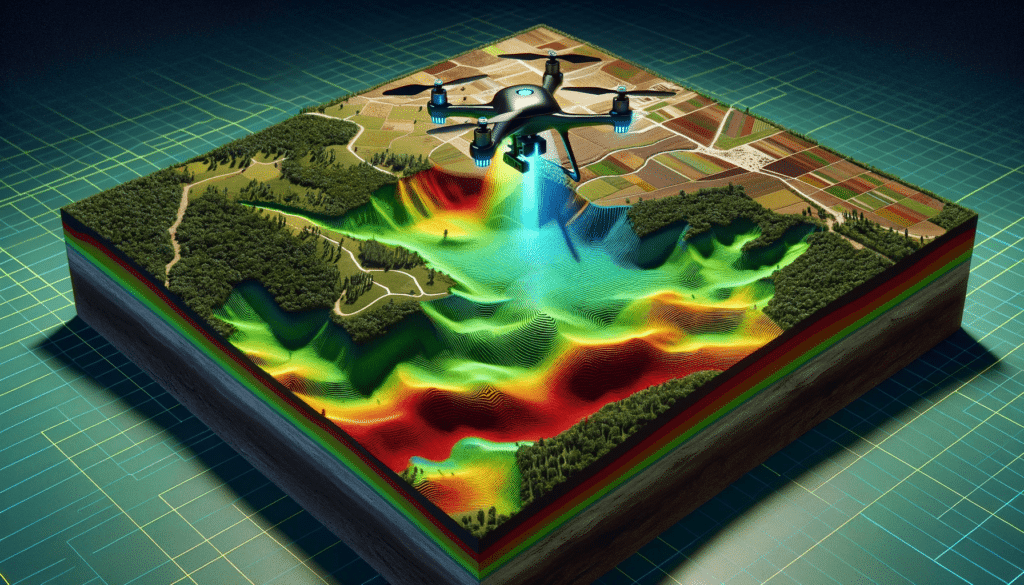
1. Airborne LiDAR
Airborne LiDAR, mounted on aircraft or drones, is widely used for topographical mapping and environmental monitoring. For instance, it helps utility companies map vegetation encroaching on power lines and supports flood risk assessments through accurate terrain modeling.
2. Bathymetric LiDAR
Designed for aquatic environments, bathymetric LiDAR measures underwater depths in coastal areas, rivers, and lakes. This technology is vital for marine navigation, coastal zone management, and hydrological studies, as it enables precise mapping of submerged terrain features.
3. Terrestrial LiDAR
This category includes two key types:
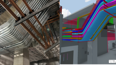
- Static Terrestrial LiDAR—This method, often used in construction, architecture, and archaeology, captures high-resolution 3D representations of buildings and historical sites with stationary scanners.
- Mobile Terrestrial LiDAR – Mounted on vehicles, mobile LiDAR is instrumental in infrastructure mapping, road monitoring, and urban planning. It provides rapid, high-accuracy data collection for large-scale projects.
Beyond these primary applications, LiDAR is also used for atmospheric studies, law enforcement (speed enforcement cameras), and environmental conservation. Its ability to generate precise, real-time spatial data makes it indispensable for several industries.
Key Benefits of 3D Scanning LiDAR
The adoption of LiDAR continues to grow due to its numerous advantages:
- Exceptional Accuracy – High-resolution point clouds enable precise measurements, meeting strict surveying standards.
- Fast Data Collection – LiDAR scanners can capture vast amounts of data in minutes, significantly reducing surveying time compared to traditional methods.
- Automated Operation – LiDAR systems function needs human intervention, but the equipment capabilities and ability for automation simplify the data acquisition reducing human error.
- Increasing Accessibility – The decreasing cost of LiDAR sensors, software, and data processing improvements has made this technology more accessible to professionals across industries.
In fact, according to market research, the LiDAR industry is projected to reach $16.66 billion by 2030, reflecting its growing adoption across multiple domains. This rapid expansion reflects the rising demand for high-resolution spatial data and the increasing affordability of LiDAR systems, making them more accessible to businesses of all sizes.
Industries Benefiting from LiDAR-Based Scanning
LiDAR technology has become indispensable across various industries, enhancing data collection efficiency, safety, and precision. Some of the key sectors leveraging LiDAR include:
1. Architecture, Engineering, and Construction (AEC)
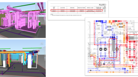
LiDAR plays a crucial role in site analysis, as-built documentation, and structural integrity assessments. It enables accurate modeling for Building Information Modeling (BIM) and supports real-time project monitoring to enhance productivity and reduce errors in construction planning.
2. Infrastructure and Transportation
Experts use LiDAR when planning and maintaining roads, railways, and bridges. Furthermore, mobile LiDAR systems mounted on vehicles allow for fast and precise scanning of highways and tunnels, improving safety assessments and predictive maintenance.
3. Environmental Monitoring and Conservation
Scientists use LiDAR to study the impacts of deforestation, coastal erosion, and climate change. The ability to generate high-resolution terrain models aids disaster preparedness and ecosystem management, making LiDAR a valuable tool for conservation efforts.
Conclusion
LiDAR-based laser scanning has revolutionized 3D reality capture, offering unmatched precision, speed, and versatility across multiple industries. Its ability to generate highly accurate spatial data has made it a go-to solution for surveying, infrastructure planning, and environmental monitoring.
The AEC industry has benefited from as-built documentation, construction monitoring, and retrofitting, reducing project risks and improving efficiency. As LiDAR technology advances, its applications will only expand, shaping the future of digital modeling and smart infrastructure.
If you want to integrate 3D laser scanning and Scan-to-BIM services into your projects, visit ENG BIM Services to see how cutting-edge technology can enhance your workflows.