Introduction
Ground penetrating radar (GPR) is a non-destructive geophysical survey technique that uses electromagnetic radiation (UHF/VHF frequencies) to locate subsurface objects by transmitting and receiving radio waves on the ground. GPR may help in finding buried pipes and cables underground, as well as cavities in the ground possibly caused by building foundations or other subterranean structures.
GPR applications
Ground penetrating radar is used in a variety of applications, including structural assessments, archaeological surveys, environmental studies and locating utilities. GPR also has applications in geotechnical investigations where it can be used to detect buried pipes or voids beneath pavement without excavation. In law enforcement, ground-penetrating radar can provide information about grave sites and cemeteries that will allow police officers to plan their search efforts more effectively.
How to read and interpret the Ground Penetrating Radar Data
How to read the data:
The whole system works to generate feedback by measuring the responses from energy pulses and displaying them on-screen either in the form of disturbances, layers, or arch-shaped images called hyperbola/parabola. With a hyperbola, an important distinction to make is that pulses travel into the ground in a cone shape, which is why readings are displayed in arches on the screen. The lower points in the hyperbola are when the target is either in front of or behind the antenna and therefore farther away. The highest point in the hyperbola is when the object is closest to or directly below the center of the antenna.
Targets such as pipes, telecommunication cables, rocks, and even buried artifacts may generate this same kind of arch on the display. However, due to a host of variables, sometimes hyperbolas may not appear clearly in data. Instead, a “disturbance” is seen.
Despite GPR’s potential, it is not without variables that impact the accuracy. When determining how effective GPR will be in each scenario, it is critical to understand these variables and know how to compensate for them.
How To Interpret the Data:
The most important thing about interpreting ground penetrating radar data is understanding what you are seeing on the screen in front of you. For example, if there were no objects underneath your home but instead just a flat area with even ground everywhere, all four corners would appear as straight lines on the screen because there would be nothing beneath them! However, if that were not true – say there was some sort of obstacle such as a large rock – then only certain parts would show up as straight lines while others might be curved depending on how close they were getting towards its location or how far away they were getting away from its location respectively. When the operator knows how to interpret these readings, GPR is a powerful device.
GPR Deliverables
Commonly, the deliverables from a GPR scan are the first markups on the field. Findings will usually be marked directly onto the surface using spray paint or permanent marker (when permissible), crayon, tape, or other methods depending on the site conditions or as directed by the client.
It’s customary to send a job summary or findings report consisting of a PDF document with a brief description of equipment used, findings, limitations, and site photos at the conclusion of every job.
Findings can be also drafted indicating their location in XYZ, in 2D CAD with an aerial image background. A linework version can be provided if the client makes an existing drawing available.
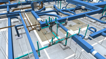
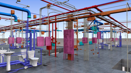
3D Models can be offered to document all findings. These ones help provide a better visual representation of reality for clients.
Understanding GPR Accuracy
When it comes to locating objects in subsurface material, ground-penetrating radar is incredibly accurate. A computer records the strength and time for the return of electromagnetic pulses and leverages sophisticated filters, called algorithms, to display this information on-screen for the operator.
However, ground penetrating radar (GPR) is not a direct measurement of the subsurface. It reflects the subsurface that has been distorted by the medium through which it passes. Therefore, GPR cannot tell you what is in your underlying subsurface; it only tells you what lies above it.
If you want to know what is happening deep underneath your footings, then you need to dig them up and take samples for analysis or use an auger probe (a long steel rod with a cutting edge on its tip) that can penetrate an inch or more of compacted fill material.
In addition, conduits and pipe depth will be marked when possible but should be treated as estimates. It is not common to see a cut over the top of any marked conduits/pipes. GPR tech cannot determine the diameters of conduits/pipes so avoid all markings by at least 3” or more whenever possible.
Strategies to improve the accuracy of Ground Penetrating Radar
One strategy to compensate for environmental differences and improve accuracy is to utilize a system that leverages multiple frequencies. These systems operate with multiple frequencies simultaneously and combine the data with cutting-edge software to provide greater depth and higher resolution imaging of the subsurface material.
Another way to improve accuracy is by knowing how to physically use the GPR system effectively. Different environments call for different scanning approaches. For example, you can improve accuracy when scanning long, linear targets, such as cables and pipes, by approaching them at 90-degree angles.
A method that works well in good soil conditions is to cross and mark as you go. The operator sweeps the cart adjacent to where they expect the utility to be and manually marks it. This can also be done in the software by tapping on the screen and placing data points.
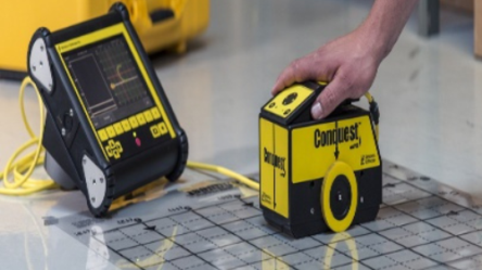
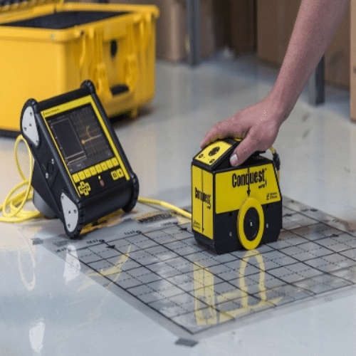
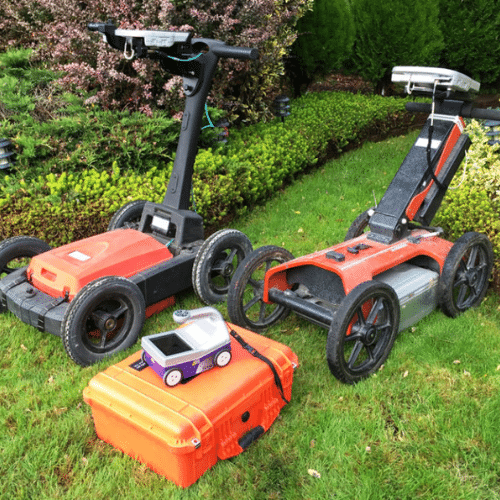
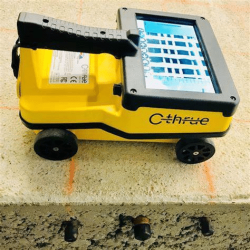
GPR Equipment’s examples
Conclusion
Ground penetrating radar is a valuable tool for monitoring and assessing the condition of underground structures; however, it can be difficult to interpret the data. Understanding how GPR works as well as some strategies to improve accuracy will help you make better decisions about your project site.
ENG
For more information, contact us!
E-mail: eng@engbim.com
Call us: (949) 340-6924